HTTP 200 OK
Allow: GET, PUT, PATCH, DELETE, HEAD, OPTIONS
Content-Type: application/json
Vary: Accept
{
"url": "https://awgrym.controlledfrenzy.co.uk/api/image/ed6dd222-4071-465c-84f8-4dd93ac5bd53/?format=api",
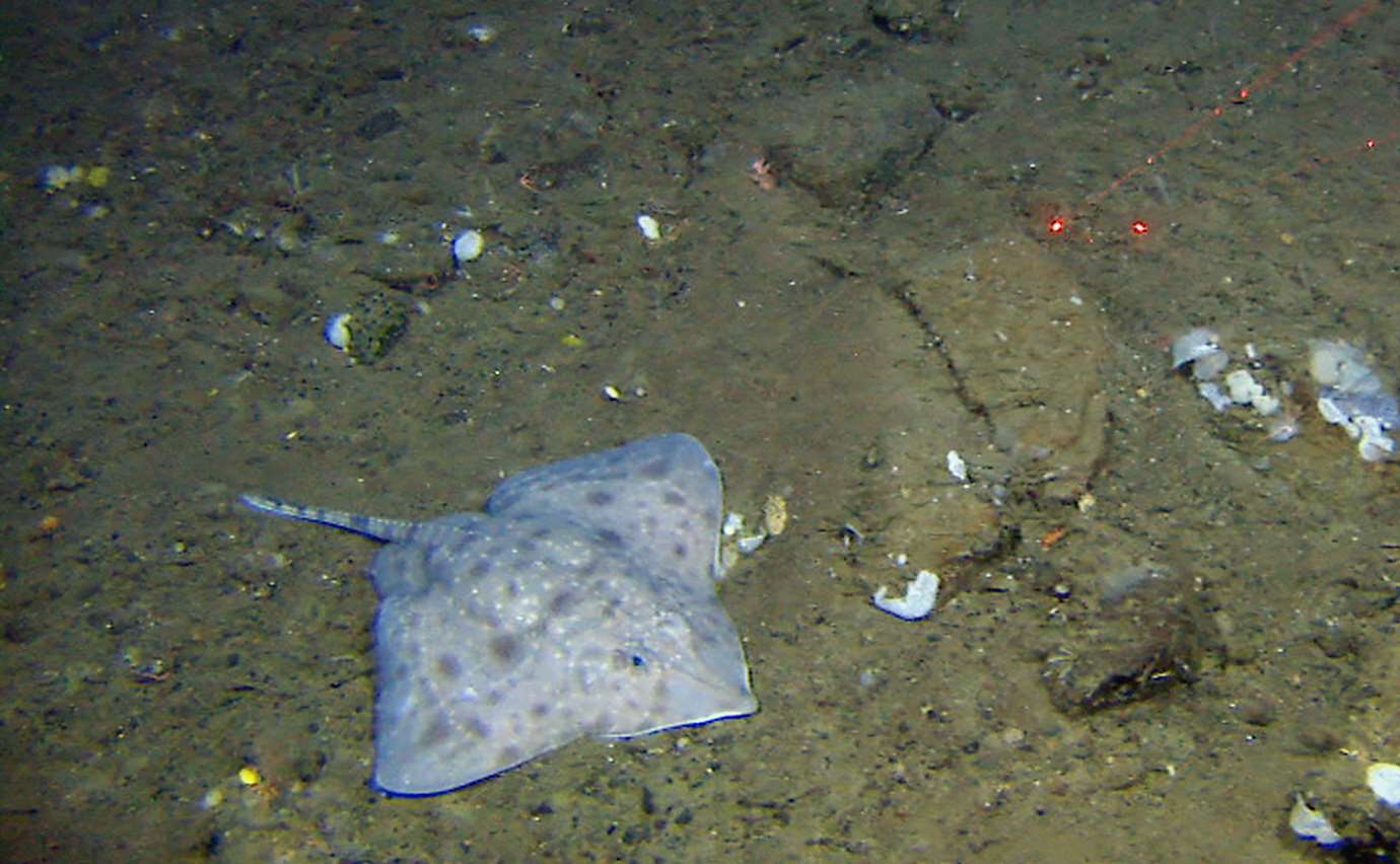
"ImageURL": "https://rmv-public.s3.eu-west-2.amazonaws.com/sidTest/flat/R372VL391b-00-04-37Skate_B.jpg",
"ImageName": "R372VL391b-00-04-37Skate_B",
"uuid": "ed6dd222-4071-465c-84f8-4dd93ac5bd53",
"region": "North Atlantic",
"importedFrom": "marinedata/Fishes.xlsx",
"insituImageName": "R372VL391b-00-04-37Skate_B",
"insituImageURL": "https://rmv-public.s3.eu-west-2.amazonaws.com/sidTest/flat/R372VL391b-00-04-37Skate_B.jpg",
"exsituImageName": null,
"exsituImageURL": null,
"physicalSample": null,
"imageCredits": "Havforskningsinstituttet/MAREANO",
"identifiedBy": "Rupert Wienerroither",
"dateIdentified": null,
"dateIdentifiedRaw": "2009",
"identificationRemarks": null,
"identificationVerificationStatus": null,
"typeStatus": null,
"rawImage": null,
"locality": "Svalbard part of the Norwegian Sea",
"locationID": 49670,
"locationURL": "https://www.marineregions.org/eezdetails.php?mrgid=49670",
"locationDataURL": "https://www.marineregions.org/rest/getGazetteerRecordByMRGID.json/49670/",
"locationData": {
"MRGID": 49670,
"status": "standard",
"accepted": 49670,
"latitude": 78.713402,
"longitude": 18.289042,
"placeType": "Marine Region",
"precision": null,
"maxLatitude": 76.564547,
"minLatitude": 72.17309,
"maxLongitude": 19.500765,
"minLongitude": 6.40419,
"gazetteerSource": "VLIZ (2020). Intersect of IHO Sea Areas and Exclusive Economic Zones (version 4) ",
"preferredGazetteerName": "Svalbard part of the Norwegian Sea",
"preferredGazetteerNameLang": "English"
},
"locationDataUpdated": "2022-03-23T16:18:55.250208Z",
"locationRemarks": "Bjørnøya vest",
"decimalLatitude": "72.3485086000",
"decimalLongitude": "15.3022167700",
"minimumDepthInMeters": "666.2060000000",
"maximumDepthInMeters": "666.2060000000",
"institutionID": "Havforskningsinstituttet",
"collectionID": "MAREANO",
"bibliographicCitation": null,
"modified": null,
"dctermsLicense": null,
"dctermsRightsHolder": null,
"dctermsAccessRights": null,
"previousIdentifications": "2",
"catalogNumber": null,
"associatedSequences": null,
"habitat": null,
"substrateType": "sandy mud and gravel",
"size": null,
"substrateMethod": "modified folk",
"projectName": "MAREANO",
"externalLink": null,
"situType": "I",
"added": "2022-03-23T16:18:55.471005Z",
"updated": "2022-04-06T15:09:42.642430+01:00",
"OTU": "https://awgrym.controlledfrenzy.co.uk/api/otu/ceeeb9e8-7ed2-4e6f-8236-3bb9312149d8/?format=api"
}